Alaska 2015

Alaska 2015

We are excited to visit Alaska and look forward to sharing our experiences with you. Enjoy the journey!

Friday, June 26, 2015

June 19, 2015

Friday, dawning chilly but still and peaceful.

Quietly and quickly taking down the tent and packing up, we left the campground around 6:30 Am.  Finding a nice little pull off area down the road a bit, we pulled over, cooked our oatmeal, and hit the road again.  We left early with several goals in mind: 1. To see the game before they moved away from the roadside.  2. We had a distance to go and did not know how long we would be delayed in traffic because of the Willow forest fire.

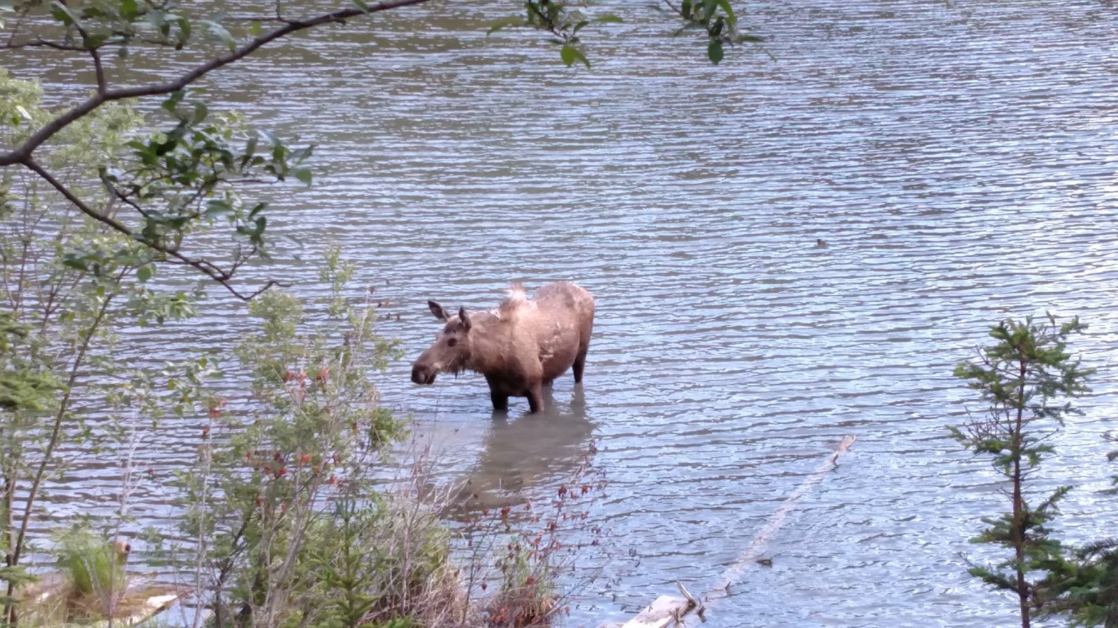
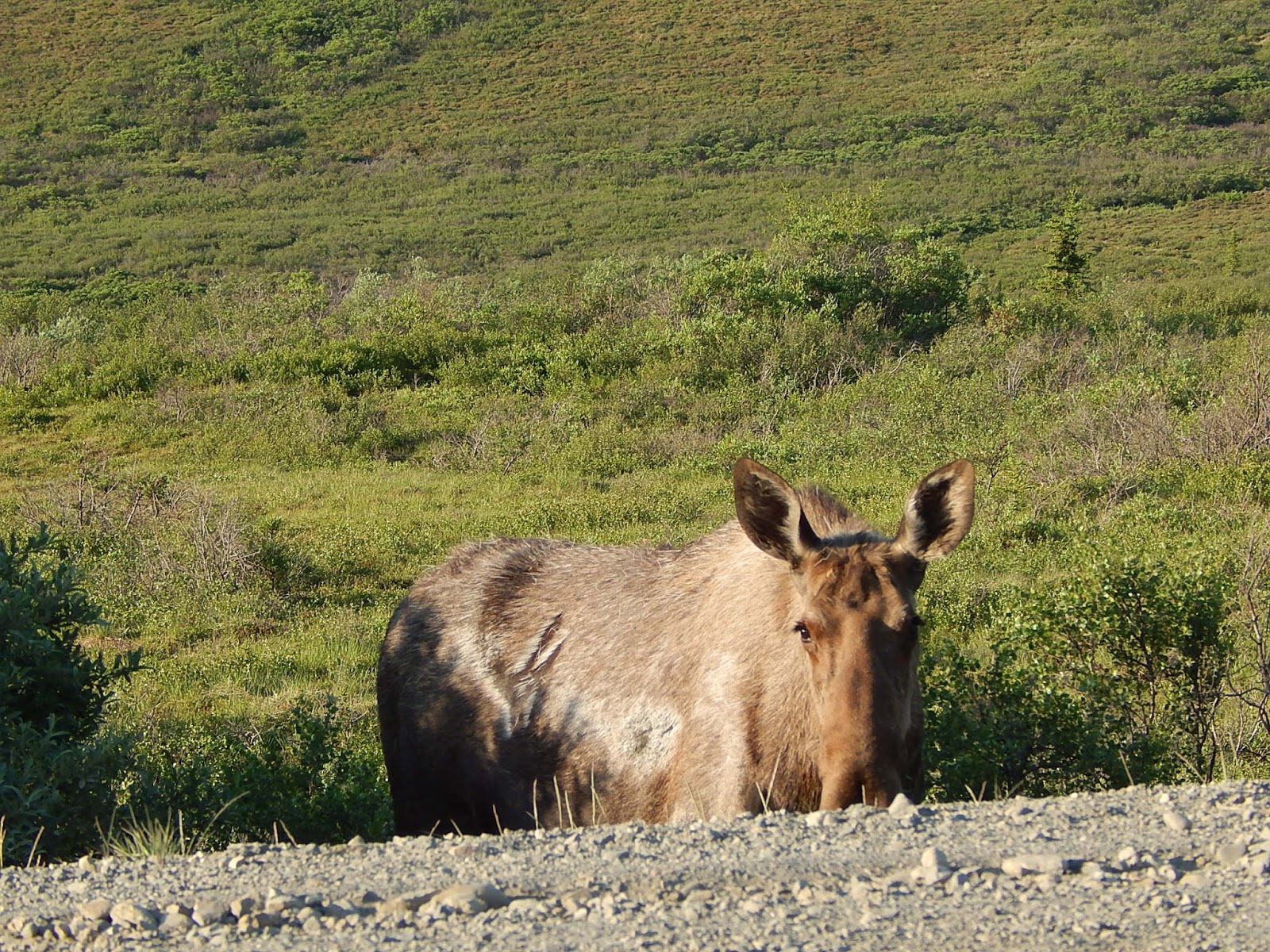
We were traveling out of the park when I happened to see just a part of a moose in the brush beside me.  So we stopped and watched for a bit, finding out to our surprise that the one was actually three! These fine young men decided to be social and joined us right up on the road.  Even young they look large!  The only other even remotely exciting thing was noticing layers of ice on the ponds along the side of the road - our sleeping bags were great!  We had no idea it was that chilly last night!


Back at park headquarters we took much appreciated hot showers and did laundry again.  Between our hike, and riding the park buses which can be extremely dusty, we were ready for the shower!


Then we hit the road heading south towards Anchorage.

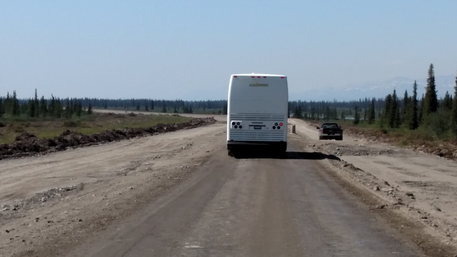
We had originally planned to get in to Wasilla and go over the Hatcher Pass, camping along the Pass a night or two and do some more hiking.  However, having met and talked with others about their trips, we decided to change our plans and feed our cultural side a bit.  Our route regardless was taking us through the Willow fire area.  As we went south there was a fine haze in the air, which we understood was from the fire.  There were quite a few delays as it is road construction season in Alaska.  With the long days, the construction companies are able to work crews almost right around the clock, getting the jobs done relatively quickly.


 Back in 2004 there was a very dry Spring, and enormous forest fires ignited, burning 6.7 million acres before the season was done.  This year, Alaska did not have it's typical snowfall, and has had a very dry Spring.  Forest fires are a real concern this year, and unfortunately those concerns are being realized.  Without really having access to much news, we have heard that the Willow fire has burned about 8,000 acres already and is only 5% contained.  There are other fires burning on the Kenai Peninsula as well but we don't know how larger.


Just on the outskirts of Wasilla is the Iditorod headquarters with a small visitor's center. (http://iditarod.com/resources/about/headquarters) This was one spot we were advised not to miss, and so took the advice.  We stopped and watched a film on the race and the care of the huskies, and enjoyed the few items posted and displayed around the building there.  There is normally a sled dog team with a summer sled hooked up that you can take sled dog rides on, but they leave before five, and we arrived after five.  So we decided to camp that night in the area and come back in the morning to see the dogs.  This was one nice thing about not having reservations in campgrounds ahead of time.  We were free to change plans and camp just wherever we were at the time.

Since we were in the Wasilla area, we decided it might be easier to go in to a campground instead of finding a roadside site again.  Wasilla is rather built up - in fact they have chains that have not even made it to Concord, NH yet!  We found both the Fred Myer and the Walmart to be very nice stores.  We found a campground not far from the Sled Dog museum and pulled in for the night.  It was an interesting experience to say the least, with many other campers having dogs, and a quick visit to another site by the police.  In the morning we found the picnic table down a hill and covered in with weeds.  We woke and packed up early, and cooked our oatmeal in the Walmart parking lot.  The campground has a lot of potential, and a nice day use area that gives access to the lake, but not a place we'd recommend camping in for any length of time as long as it is in it's current condition.

As things turned out, this was our last night sleeping out in the fresh, cool air of our Alaskan vacation.


June 18, 2015


Our second, and last day in the Park. What to do?

After looking at our options we have decided to take it easy this morning, sleep in, and catch a later bus to take us deeper in to the park. We had hoped to hike today as well, but as these hikes are a full day's adventure, we would not then be able to fit in seeing the other scenery and perhaps wildlife in the Park. Perhaps if we were twenty years younger....

Other reasons to take the later bus: the early buses are full; the early buses return during the mid day and are hot; returning during the mid day limits the animals you see as they are bedded down in the cool shade during the hot part of the day. So, we planned to take a later bus, which means driving out during the mid day, but returning in the evening and from what we hear, seeing many more wildlife. Also the sun will not be a strong and thus be better lighting for any photos we take along the way.

Question is, was this a good plan? Did it work?

It worked! We really enjoyed the lazy morning at camp, visiting with some of the other campers, and catching up on this blog (though we can't post them till we have internet tomorrow). We are on vacation and have been pretty busy going, seeing, and doing, so it was nice to just be.

We caught the bus around 2:00 and rode it out to the Eielson Visitor Center, which is 66 miles in to the park. Along the way and at the various rest stops, we enjoyed the scenery and the others on the bus. We did catch sight of some sheep and a young or female caribou, but none close enough for photos.


We finally arrived at the Eielson Visitor Center stop around five, which gave us a little time to walk around and enjoy stretching our legs. There are a nice visitor center inside, and some hiking options, ranging from easy to more difficult, around the area. We had originally planned to come out early and hike one of the peaks out here, but ended up taking the morning off. 


6:30 rolled around and found us on the bus for the journey back. The sun does not set at this time, but does go down enough to soften the light, and brighten the colors of the mountains around us. We will post some pictures, but they just don't do the live experience justice. It was definitely worth waiting until later for the trip! Also, there were only a handful or us on the bus, so when we did see game, you could get to a good spot to watch and take photos from. We did have a neat opportunity to watch a momma bear and her 2 cubs browse an area, though the mom was behind a bush from where I was, so I'll post pictures of the cubs. We also had a great opportunity to watch a caribou that was quite close to the road. 


Back at camp around 8:50, a quick walk to stretch our legs then off to bed for an early start in the morning.


Friday, June 19, 2015

June 17, 2015
Denali National Park.  What a beautiful place!
As we were driving in yesterday we had to go through a checkpoint, as personal vehicles are allowed only so far in to the park.  The ranger was very excited for us when she heard which campground we were staying in.  As we arrived rather late, there were only two sites left to choose from, and one had a park ranger vehicle on it so we took the other.  It is a very nice campground along the river, and is a very popular place to stay.  We had made our reservations back in March, and by then the reservations were filling up.  So plan early - especially if you plan to come in July or August when there are even more tourists in the area.
There are several other campgrounds in the Park.  There is one right at the main entrance, which was also full already, and there are several you are not allowed to take your vehicle to.  Basically you have to plan to tent camp there, packing everything in with you on a Park bus.  
On of our desires was to do some hiking in Alaska.  We have found the distances between destinations along with the scenic stops to eat up quite a bit of time, and have not yet had the chance to do many hikes.  So, the Park was it.  We were going to finally get some hiking in!
As Bob mentioned, we picked up topo maps when first arriving at the park.  These maps have one inch representing about one mile, verses the one inch representing about five miles.  So, after spending some time the evening before planning our first day hike, and packing our backpacks for the trip, we were excited to get up and get started in the morning.
We first caught a bus at the entrance to the campground (which is about an hour into the park already), and took it about an hour to the trailhead of the hike we wanted to take.  Along the way we did manage to see some Dall sheep, and four bears.  One bear was by itself and the other had two year-old cubs with her.  Of course, we saw these bears in the last few  miles of our bus ride.  It felt rather forlorn getting off the bus in the middle of the wilderness, alone, knowing you really are in bear country.  
Our goal on this hike was to climb Sable Mountain.  This rises to about 5900 feet, with the road starting you at about 3200 feet.  Using the topo map, we followed a creek up the valley for quite a ways, then started climbing a ridge which would take us to the top of Sable Mountain.  The hike we were attempting actually is rather popular, and we were able to follow a trail for most of the hike.  We were sure from the prints we occasionally saw that these trails are shared by animals as well as humans.  


For the time we were walking along the creek bed, there was quite a bit of brush around us, so we did the bear call rather frequently.  As we got further and further up the valley, the trees thinned out around the creek, and as we climbed away from the creek were found ourselves on soft, spongy tundra.  The views changed constantly and were each equally stunning.  The wild flowers we had heard so much about before our trip were everywhere!   Some were the same as we have seen along the roads, others were new and different to us. We started taking pictures of some, but as time went on there were just too many to keep stopping for.  As most would expect the flowers on the tundra were extremely tiny, and were just beautiful!


Well, at around 4900 feet up I started feeling a bit dizzy.  This was a new feeling for me to experience while hiking.  We had been going up a fairly steep ridge, which narrowed to about three or four feet wide in places.  As we looked down to find where to step next, we would see the mountain drop right down on both sides of us.  While never feeling afraid, as it was not really a cliff, I figured the drop off in view as I was looking down was causing the dizziness.  We had to stop frequently to catch our breath, and during these brief stops the vertigo would calm down, so I climbed on.  We went this way for another hundred feet or so, when I finally had to tell Bob I felt I should not go on farther.  He went on up to a rise we were just below and took some pictures of the view we did reach, however we were still about 900 feet from the top.  

As we were descending Bob said he had been hearing voices, and sure enough we were able to see two other hikers coming up the creek bed below us.  By the time we got down, we happened to cross paths and they said there was a better ridge just a bit further up the creek we should have taken.  By this time, we were concerned that we get back to the road in time to catch a bus, and truthfully did not think we had it in us to do another climb like that just then.  So, upon reaching some shade, we stopped for lunch and a rest, then made our way back to the road.
Just two brief side thoughts here:  One: It is very hard to get lost here.  The hikes most people do overlook the road and are mostly tundra.  The White Mountains, where we do most of our hiking, are heavily wooded and it is very easy to get lost.  Secondly: the weather has been very warm.  Warmer than we anticipated for this time of year.  The rest time in the shade was great, and packing layers of clothing was the smart thing to do.  
Once back on the road we started walking toward our campground as we were not sure when the next bus would come, and hey, maybe those bears would still be along the road!  I don't know whether to feel relief or disappointment in the fact that we walked two whole miles along the road and did not see any bears. Finally a bus came along with two seats left and we hitched a ride back to our campground.
In later discussing the hike with a Park ranger, he said the people attempting to climb Mt. McKinley define a hike successful if they come down alive, regardless of whether they reach the top or not.  So I guess you could say we had a successful day in spite of not reaching the peak.  
June 15 - 16, 2015
Last night was interesting.  Neither of us had much sleep with Esther even less.  Denali Hwy is suppose to be generally less traveled than other roads which was one reason we decided to take this road.  That and the scenery.  Alaskans use this road quite heavily on the weekends as there are many places to camp and use ATV's along the road, as with most roads in Alaska.  Alaska is soooooo big that even with all the ATV trails , the trails are miles apart.  And after discussing this with the locals, it seems that most Alaskans have respect for the environment and stay on the trails.  We have been impressed. The Alaskans play hard on the weekends and that means that they travel back to their homes even late into the night.  Yesterday was Sunday and the final day of the weekend.  We had camped a 100 ft off the road over looking a beautiful valley, that was home to a cow moose and her twins.  You remember them from the last post: Rodney and Robert.
Still we had poor quality sleep.  There is another reason it seems for poor quality sleep that we found out about a couple of days later.  There is an 8000 square acre forest fire that at times shuts down the Parks Road and so people are taking the Denali Hwy, which adds another 200 miles to their trip, to get to Anchorage.  And explains the heavy traffic on this road which is normally more desolate. When we leave Denali National Park the end of this week, we will need to determine whether we will need to do that same thing.  Missing our flight on the 22nd is not an option.
We left our camp site after 9 that morning and soon were able to see Maclaren Glacier to the north.  We stopped at Maclaren Lodge, that sits along the Maclaren River, about 14 miles from the Glacier.  We took a break and  had their fabulous Berry Pie.  It contained strawberries, apples, rhubarb, and raspberries.  And a great crust.  And what pie would be complete without ice cream?  Organic Vanilla Beans from Madagascar.  Yum Yum!  A nice lodge that would make a great night for those of you thinking of an Alaska trip. (http://www.maclarenlodge.com/index.html)
While at the lodge we walked out back to a pond and saw another cow and her twins.  Since they need names as well we named them Jacob and Shelby.

We back tracked a few miles to the top of the escarpment and hiked 2 1/2 miles out to the Maclaren Summit where we had stunning views of Maclaren Glacier and Eureka Glacier.  As is proper when walking and hiking in bear country, we frequently shouted out 'hey bear'.  Best to let them know you are in their neck of  the woods so that they have time to move out of your way.

We continued traveling west and marveled at how the geography, trees, and land continued to change.   The main types of trees we saw were Aspens, White Spruce and Black Spruce.  We passed over the Maclaren River, had stunning views of the Susitna River, and camped that night along the Brushkana River.  

The middle section of the Denali Hwy did not seem to have the stunning views that we had on the east side.  Partly because there were more trees along the road. Much of the east side was above tree line and so you looked out over high alpine tundra which afforded great views.  There were more views as we approached the west end and the town of Cantwell on the Parks Hwy.  The middle section is great country for hunting, and has quite a bit of mining history where both copper and gold were mined.  While there are still some private claims it seems all the larger operations along this highway are shut down.  For much of the last day on the Denali Hwy we followed closely the Nenan River, which is also Glacial.
Upon arriving at Brushkana campsite, which is a nice BLM campground with many sites right along the river, we were immediately swarmed by mosquitos.  Mosquitos seem to be almost everywhere but this rivaled the stories we have heard and read about.  We quickly set up our tent in only minutes and jumped inside without supper.  The next morning we woke to what was literally hundreds and hundreds of mosquitos on the outside of our tent netting.  The goal of a good nights sleep was achieved as the mosquitos stayed on their side of the tent netting and we on ours.  Like last night, pack up was done quickly and we stopped a few miles down the road for breakfast where there were basically no mosquitos.

After joining the Parks Hwy, where we would head north to Denali NP, we stopped for fuel.  We also took time to make a few calls and send out the latest postings to Phillips footsteps.
We headed north to Denali NP and on arriving checked in at the campground headquarters, did laundry, and had a much welcomed shower.  We visited the Backcountry Access Center and talked with a ranger for suggestions on where to hike and get some detailed topographical maps.  These are very important here because Denali NP contains 6 million acres with virtually no trails.  Hiking is done by walking across the tundra in any direction you wish to go.
We then headed 30 miles into the park to the Teklanika Campground where we would spend the next 3 nights.  On our way in we saw nice caribou with velvet still on its antlers.  We arrived at 8 pm and set up camp excited about our days ahead.


Tuesday, June 16, 2015

June 14, 2015
We start the day at 6:30 am having breakfast and packing up the camping equipment.  We had camped along the Little Tonsina River which turned out to be a parking spot for those heading off on their 4-wheelers.
Although we went to bed about 9 pm the sun was still 'up' and so were the Alaskans.  Our sleep was interupted frequently by Alaskans out playing.  Since the summer days are long and bright compared to the dark long winters, they tend to take advantage of every  moment of light they can.  Which, here in the Land of the Midnight Sun, is 24 hours a day in the summer.  And being a weekend night, play time is around the clock.
We headed north to Glennallen which was only about 50 miles away.  We did find a great deal on gas.  The sign read $1.49 per gallon so I pulled in.  Nothing to buy here as the place closed down years ago but Ieft with a few pictures.  For those of you into wood working you might know the term burl wood.  Its basically a large sore on a tree that, as the tree grows, becomes well pronounced.  These burls can can be turned into beautiful pieces wood project by craftsman.

Back in Glennallen we stopped in at the Caribou Gift shop and found it to be well stocked and reasonably priced.  The Hotel looked very nice as well, though we did not stay there. (http://www.caribouhotel.com/giftshop.htm)  We found a laundry and did our 4 days worth of clothes. While waiting for the clothes washer we met a retired couple from Colorado.  Turns out they are doing almost the same route we are just in the reverse order.  In talking we them we found out that we have something else in common.  They are also believers.  We had a great time with them.
In researching for our trip, I had read numerous reviews about The Thai Tok Food Truck. Yes, traditional Thai food in the last place you would expect to find it.  Between the reviews and the many stopping to get take out and  so wanted to try it.  Fantastic food.


Back on the Richardson Highway eading north.  One thing you notice quickly here is that the terrain and vegitation changes in only a mater of miles.  You can go from forested land, to alpine tundra with no trees and over 4000' passes in not so many miles.  It is fascinating to watch.
We stared out the morning at mile post 74 on the Richardson Hwy and went north of Paxson to mile post 215 were we turned around.  At about mile 150 you crest a rise in the road where it is possible to see three moutain ranges in a 360 degree view.  They are the Alaska Range to the north;  The Wrangle Moutains to the south east;  And the Chugach Mountains to the south and west.  As we keep saying, it is difficult to capture the awesomness in pictures.
North of Paxson we traveled through Isabel Pass and again were able to see the pipe line.  Through out our travels along the Richardson Hwy we have followed the Alaska Pipeline.  We marvel constantly at the engineering involved as it makes its way up and over mountain passes, through the low lands, and under and over rivers.  (http://www.explorefairbanks.com/go/energy/trans-alaska-pipeline/27)


We traveled as far North as Miller River, mile 215, where we saw two things.  
First, to our east we marveled at Rainbow Ridge.  The mountains and ridges were named for &their varicolored talus slopes&.  The reds and greens are volcanic rock.  The yellows and pastels are siltstone and sandstone.
Secondly, the river banks along the Miller Riiver were covered in wild flowers.  We have enjoys the wildlflowers here and this alone was a spectacular sight.  We wished we could have bottled the scent!


Having turned around we traveled back 30 miles to the Denali Hwy.  Don't let the word 'highway' fool you.  Everything here is named highway.  The Denali Hwy is 135 miles of gravel road.  We couldn't wait as this was intended to be one of the highlights of the trip.  Compared to the other roads in Alaska this one is not as well used.  
For many years this was only route to get to Denali National Park but that changed in 1971 when the Parks Hwy was built from Palmer north to Denali National  Park.  This 'new' road meant that the vast majority of the traffic to Denali National Park did not need to use the Denali Highway. (http://www.blm.gov/ak/st/en/prog/recreation/denali_highway.html)
We traveled the first 30 miles before making camp for the night.  There are many spots along the road to just pull off and camp.  We choice a bluff over looking a valley with many ponds and the Amphitheater Mountains directly in front of us.  Now, the whole reason for taking the Denali Hwy was to see wildlife, the many wildflowers, the terrain, and to be remote.  Basically as few people as possible.  While setting up camp Esther was using the binoculars and soon spotted a female moose and her twin calves.  Since they didn't have any names I decided to name them Robert and Rodney.  Unfortunately they were too far away for a photo.  We also saw trumpeter swans and loons.
Although the sun was still up went to bed at 10 pm.  Up again at midnight to get a photo of the sun just below the horizon to the north.  Yes, north.  In June here the sun sort of makes a circle around you.  

10 PM

12 PM


June 13, 2015
While the last few days were outstanding, it is time to move along.  Heading out once again on the Glenn Highway, we stopped just a few miles up for a quirky photo op.  It has become local tradition for people to stop along the highway and spell their names with white rocks on the black shale hillside.  So, since we are celebrating our 25th anniversary we put a B followed by a heart and an E.  OK - you can say Awwww....and our kids will gag....

Just a side note as we drive by the Long Rifle Lodge again, our waitress was a young college student from Wisconsin, who is working here for the summer.  We have met several students doing this and yet hear that businesses do have a hard time finding summer help.  What a neat opportunity for these kids we are meeting!
Back on the road now, we pass many interesting sites:  Gunsight Mountain which looks like a gunsight!  Nelchina Glacier; a creek where recreational gold panning is done; and on and on.  At Milepost 129 from Anchorage, there are these strange poles that go up and over the edges of the roads.  These are guide poles marking the edge of the roads for those plowing in the winter.  

As we continue on, reaching about Milepost 165 you start getting magnificent views of The Wrangell Mountains.  There are three peaks especially prominent:Mt. Drum, Mt Sanford, and Wrangell Mountain.  Wrangell Mountain is still an active volcano, and at times you can see smoke spewing from the top.  An interesting note - most of the mountains in Alaska do not have names! And many of them are so remote and so rugged they remain untouched at this time.  
Continuing on, we reach the Junction of Highway 1, The Glenn Highway, and Highway 4, The Richardson Highway.  Right at this Junction is a little town called Glennallen.  This is actually a busy little town, with a State troopers post, a school, a library, a grocery store, a general store, gas stations, two churches that we noticed, a four year Bible College, and businesses to meet tourist needs.  The Hub is well mentioned in tourist information packets, but we were not too impressed with the trinkets they sell.  We were appreciative of being able to get gas though!  Be sure to plan ahead and to make sure you have gas for your planned travel as gas stations are few and far between!
With the desire to run down and see Valdez, we headed South on the Richardson Highway.  Just out of town there is a nice overlook of the Copper River Valley and the Wrangle Mountains.  Then just a bit further is the Wrangell-St. Elias National Park and Preserve Visitor Center.  This is worth the stop to learn about the Park, and the general area.  http://www.nps.gov/wrst/index.htm


It's salmon season!  And the fishermen are out in droves to catch their yearly supply of salmon.  This is a picture of the Klutina River and the activities going on there.  


So many sights today! We frequently catch glimpses of the Alaskan Pipeline, various rivers, and mountains  as we travel on.  The next thing of special interest would be the Worthington Glacier and Thompson Pass.  We felt the glacier was anticlimactic after the grandeur of the Matanuska Glacier, but it was still worth the stop to see it. (http://dnr.alaska.gov/parks/aspunits/kenai/worthglsrs.htm)
(http://www.alaska.org/detail/worthington-glacier)  Thompson pass offered many more stunning views, interesting historical information about early gold rush and explorers in that ares, and many, many waterfalls. (http://www.alaska.org/detail/thompson-pass) On down in to Valdez, which can seem to be a sleepy little town, but actually has quite a bit going on.  If you have time there are many tour options involving kayaks, glaciers, the ocean, and marine animals.  Then for those who prefer to stay on dry ground there are plenty of opportunities to hike in to falls, or other areas of interest. (http://valdezalaska.org/) We walked the waterfront, then hopped back in to the car, heading back north on the Richardson Highway to find a place to camp for the night. 


Sunday, June 14, 2015

June 12, 2015
Glacier View, is an unincorporated community along the Glenn Highway.  While their address is technically Sutton, they are about a forty minute drive north of Sutton.  The highway follows the general route of the Matanuska River up to and beyond the Matanuska Glacier.  The tourist businesses in the area include a zip line, glacier hike, lodging and dining.


We were blessed to have a friend from NH and his wife to host us and "tour guide" us around for a few days.  Lee and Suzi moved to Alaska over forty years ago, after meeting at the Victory Bible Camp, (http://www.vbcalaska.org) which happens to be right up the road from their current home.  

We enjoyed our stay in this area so much, it's hard to narrow down the highlights!  Our two nights in their home allowed us to adjust to the time difference, and learn so much about life in Alaska - past and present.  
On Thursday night after supper, Lee took us on a driving tour of the Bible Camp area.  It was during this tour that we were able to get a nice picture of a Moose eating in a pond.  Lee identified it as a yearling.


Friday we enjoyed being taken down to the foot of the glacier and hiking up onto the the glacier.  This particular glacier is 27 miles long from the ice fields up in the mountains to the point it stops.   What you see in the photos below is just a tiny part of it. 


Lunch time found us enjoying hamburgers at the Long Rifle Lodge.  In additon to great views of the glacier, they have rooms to rent, and a nice little restaurant.
http://longriflelodge.co/

After some more sightseeing of the area, seeing the "Lion's Head" and another fine meal at our host home, we enjoyed some four wheeling!  Even though it was nine at night we had plenty day light to check out some of the local trails, and do some fossil hunting along the way.